Archive for the ‘Data’ tag
Painting a Picture of the “Era of Peak Water”
Wired has a great article on the “era of peak water”. The author, Matthew Power, makes an argument for the need of more and better data:
One barrier to better management of water resources is simply lack of data — where the water is, where it’s going, how much is being used and for what purposes, how much might be saved by doing things differently. In this way, the water problem is largely an information problem. The information we can assemble has a huge bearing on how we cope with a world at peak water.
The article investigates the problem of water scarcity by looking at three case studies:
Chandler, Arizona, in the US South-West dessert, where Intel currently has three chip plants running. And chip plants need a lot and very clean water. Of course, Intel will always have more money than the average water needing person.
London, UK, where Thames Water, a private water-supply company, needs to deal with old and leaking pipe networks
Australia, “the most arid continent after Antarctica”, where droughts have catastrophic effect on rice farming. Of course you might ask, why try to grow rice in an arid region?
On top of agriculture, industry, and human needs, all of which grow on a global scale, the impacts of climate changing towards more extreme conditions effects the water supply at all those three sites negatively and severely.
Measuring
Observing and measuring occurrences in nature is the basis for any science, and is the basis for any engineering related to nature. Environmental engineering is very much related to nature. The problem with measurements is that they take time and are expensive. Nevertheless, every model used for prediction/forecasting needs to be calibrated on relevant and significant data. In some middle scale this is an ok task, say measuring the relevant parameters for a gasoline spill from a gas station is feasible. However, things get very complicated on both sides of that scale: moving towards the pore scale, or towards a capture zone, a watershed, or even bigger (maybe global) scale makes things even more difficult. Some questions that might arise include: How do you measure something at a pore scale? Has anybody ever measured groundwater velocity? Really? How do you measure hydraulic conductivity and which value do you put into a groundwater model? How do you access/store the collected data if you need to collect data on a global scale? I could go on…
If a time-component needs to be included, managing what data needs or should be gathered and managing the gathered data can get out of hands, even with today’s fairly sophisticated data managing and analysis tools.
Maintaining a measurement network is a difficult task, but initiating a measurement network something completely different. Sometimes however it happens that somebody or a group of people have the foresight to measure something, or to start to measure something, and the result is an incredible data-set: the tritium isotope data-set started 1952 in Ottawa, Canada, or the measurements of CO2 on Mauna Loa in Hawaii by Charles Keeling starting in 1958. How cool are those data-sets?
Special Issue of “Nature”
Nature has a special issue on ‘earth observation’. I think all articles are important — here are a few interesting thoughts:
The editorial “Patcing Together a World View” sets the stage: It points out how important measurements are, that they make us see things in a different way. He also addresses computers with geographic information systems as the tools that enable us to pull all the gathered data together
The creation of these new ways of seeing the world would be a significant aesthetic achievement even if they had no commercial, scientific or strategic use. In fact they have all three — as well as an even greater environmental usefulness.
Alexandra Witze points in her article “Not Enough Eyes on the Prize”, that often the same things are measured by different agencies, or different countries, funneling funds away from other new measurements. She also points to the problem of measuring things in new (“exciting”) ways with new techniques versus the needs for operational measurements on a regular basis
Declan Buttler paints in his article “The Planetary Panopticon” a picture of real-time monitoring everywhere on earth. This requires instruments/satellites, computers, and still, a lot of money. He quotes Rick Anthes:
A user will be able to get, on demand, climate, or any other information for any place on the planet, on the land, in the oceans, or in the atmosphere, at any time, past, present and future.â€
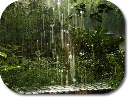
Measuring Rain
Measuring how much rain falls during a given time, the meteorological parameter “rainfall intensity”, is difficult to measure. It gets even more difficult if the goal is to measure the spatial distribution of rainfall, and how it changes over time.
The Convective and Orographically-induced Precipitation Study (COPS) will try and use different new remote sensing techniques and proven ground based or air borne techniques such as lidars, radars, precipitation detectors. Obviously over a large are, the Black Forrest in south-west Germany. The german news station ZDF has quite an enthusiastic report on this measurement-campaign and the improvement the scientists will gain for mathematical weather forecasting.